fbpx

Bistreț

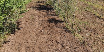
Location: Bistreț commune, Dolj county

GPS coordinates:

  • Plot 1 – Exploitation road 410 Bistreţ-Călugăreni: lat. 43.882637, long. 23.467487
  • Plot 2 – Communal platform: lat. 43.897438, long. 23.497956
  • Plot 3 – Bistreţ water collection station: lat. 43.902368, long. 23.548420

Objective: to create forest belts for the protection of access roads, public interest objectives and agricultural land

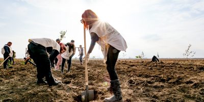
Project start: autumn 2019
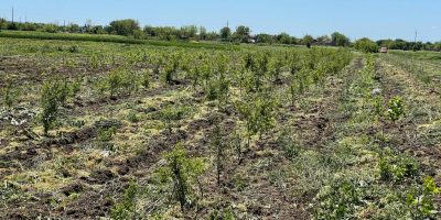
Area: 2.5 ha

Area planted: 2.5 ha

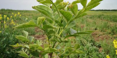
Species planted: South European flowering ash (Fraxinus ornus), ash (Fraxinus excelsior), Siberian elm (Ulmus pumilla)

Volunteers involved: 200 people

Maturity stage: autumn 2024 (estimated)

Current status: under care and completion work

Partners: OMV Petrom, under the project “Romania plants for tomorrow”.


Reason for choosing this location for the forest belt:

Bistreț commune is strongly affected by desertification, just like many other localities in the south of Dolj county. Both soil analyzes and on-site observations showed the advanced level of degradation of these lands, which completely lost their soil fertility, following prolonged periods of drought and erosion by wind.

Another problem facing the town is the spring floods. The large amounts of precipitation characteristic of this season, together with those from the melting of the snows, cannot be retained by a little natural vegetation and thus end up producing floods both in the Danube meadow and near Lake Bistreț.

The land provided by Bistreț Town Hall has a total area of ​​approximately 2.5 ha, consisting of 3 plots located in different locations.

“Adoptă un copac”, in partnership with OMV Petrom, through the project “Romania plants for tomorrow“, undertook the task of planting new forests on all 3 plots provided by the Town Hall.

Photo gallery

Bistreț 2022
Bistreț 2020
Bistreț 2021
Bistreț 2019
Scroll to Top